Professional UAV Services · UK & Worldwide

SEE
FURTHER.
KNOW
MORE.

01Drone Inspection
02Aerial Photography & Film
03Surveying & Mapping
04Construction Monitoring
CAA Approved · PFCO Licensed · Fully Insured

Where precision meets altitude. Altitude Drone delivers intelligence from above — transforming complex aerial challenges into clear, actionable data for the industries that build Britain.

500+
Missions
Complete
CAA
Licensed &
Approved
4K
Ultra HD
Capture
48H
Turnaround
01
01 · Service

DRONE
INSPECTION

Eliminate risk. Eliminate scaffolding. Our inspection drones access the inaccessible — delivering thermal imaging, HD visual data, and detailed defect reporting for structures where traditional access is costly or dangerous.

Roofing & FacadesPowerlinesBridges & StructuresSolar PanelsThermal ImagingDefect Reports
ENQUIRE NOW
Resolution
4K / 48MP
Thermal Sensor
FLIR Radiometric
Max Structure Ht
Unlimited
Report Format
PDF + Raw Data
Turnaround
48 Hours
Coverage
Nationwide
02
02 · Service

AERIAL
PHOTOGRAPHY
& FILM

Cinematic 4K capture from perspectives that redefine how your project is seen. Whether it's a luxury property, a commercial development, or a live event — we frame it with editorial precision and deliver footage that moves people.

4K / 6K VideoReal EstateEvents & FilmCommercialHDR Stills360° Panoramas
SHOT 01 · PROPERTY REVEAL4K
SHOT 02 · COASTAL ORBIT4K
SHOT 03 · COMMERCIAL GLIDE4K
100%
SAFETY RECORD

CAA GVC Zero-Incident Approval Rating.

±2CM
RTK PRECISION

Centimeter-level absolute accuracy.

48HR
DATA DELIVERY

Rapid turnaround on core deliverables.

03
03 · Service

SURVEYING
& MAPPING

Millimetre-accurate topographic surveys, orthomosaic maps, and point cloud data — delivered faster and at a fraction of the cost of traditional ground surveys. Ground Control Points included as standard on every project.

Topographic SurveyOrthomosaic MapsPoint Cloud / LiDAR3D ModellingVolume CalculationsGCP Accuracy
GPS Coordinates
53.2307° N, 1.4213° W · Accuracy: ±15mm
04
04 · Service

CONSTRUCTION
MONITORING

Keep stakeholders informed and projects on track. Regular scheduled drone flights capture site progress, verify milestone completion, and generate time-lapse documentation from groundworks to handover.

Progress ReportingScheduled FlightsTime-lapseSite SafetyStockpile VolumeClient Portals
GROUNDWORKS
Week 01
FOUNDATIONS
Week 04
STEEL FRAME
Week 10
In Progress
ENVELOPE
Week 18
FIT-OUT
Week 28
HANDOVER
Week 40
Vertical Markets

SECTOR
SPECIALISMS

Providing high-stakes data across the most demanding industrial sectors in the UK. Our specialists understand the unique safety and reporting requirements of every landscape we fly.

CONSTRUCTION

CONSTRUCTION

Weekly progress monitoring, volumetric earthworks analysis, and BIM design overlay verification.
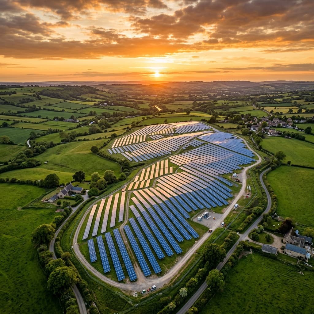
UTILITIES

UTILITIES

High-voltage pylon inspections, solar farm thermal audits, and pipeline corridor mapping.
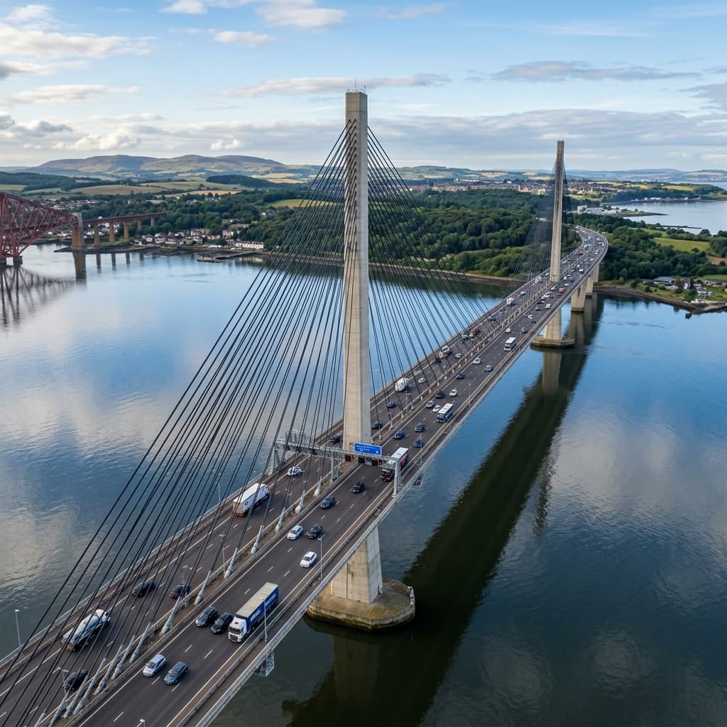
INFRASTRUCTURE

INFRASTRUCTURE

Strategic surveys for bridges, reservoirs, and rail networks using LiDAR and high-res imaging.
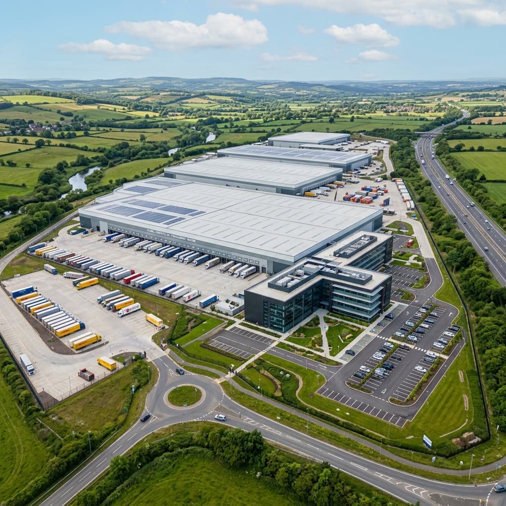
FACILITIES

FACILITIES

Complete building envelope audits, roofing thermal signatures, and planned maintenance cycles.

PUBLIC SECTOR

PUBLIC SECTOR

Heritage site digital twins, archaeological mapping, and emergency aerial support frameworks.

Strategic FAQ

OPERATIONAL
INTELLIGENCE

Our enterprise assets like the Matrice 350 RTK are IP55 rated, allowing for operation in light rain and winds up to 12m/s. However, for high-precision surveying or thermal auditing, we recommend dry conditions for maximum data integrity.

Yes. All our pilots are CAA GVC certified, which includes permissions for night operations across the UK. We utilize high-intensity lighting and thermal sensors for low-light infrastructure inspections.

Standard visual data is delivered within 24-48 hours. Complex LiDAR point clouds or 3D digital twins typically require 3-5 business days for full processing and quality assurance.

Absolutely. We carry £10M Public Liability Insurance specifically tailored for industrial UAV operations, including flight in congested areas and critical infrastructure proximity.

As part of our mission planning, we manage all necessary NOTAMs, landowner permissions, and stakeholder notifications to ensure a fully compliant and friction-free deployment.

Ready to Fly ·

LET'S
GET
AIRBORNE.

Define your mission. Our pilots and data analysts are standing by to deliver the technical intelligence you need.

Ops Desk
ops@altitude.drone
Direct
+44 (0) 20 7946 0123
Territory
UK Wide Operational Support